Surveying & Design Services
Miles Water Surveying are a branch of Miles Water Engineering. We have been undertaking surveys for over 40 years for a wide range of clients across the UK.
Our survey work includes: Private Gardens, Country Estates, Agricultural Fields, Ponds and Lakes ahead of desilting and maintenance, Wetlands, Riverbanks and As-Built schemes. These surveys fall into four main categories.
- Topographic Surveys: These describe existing site levels and features.
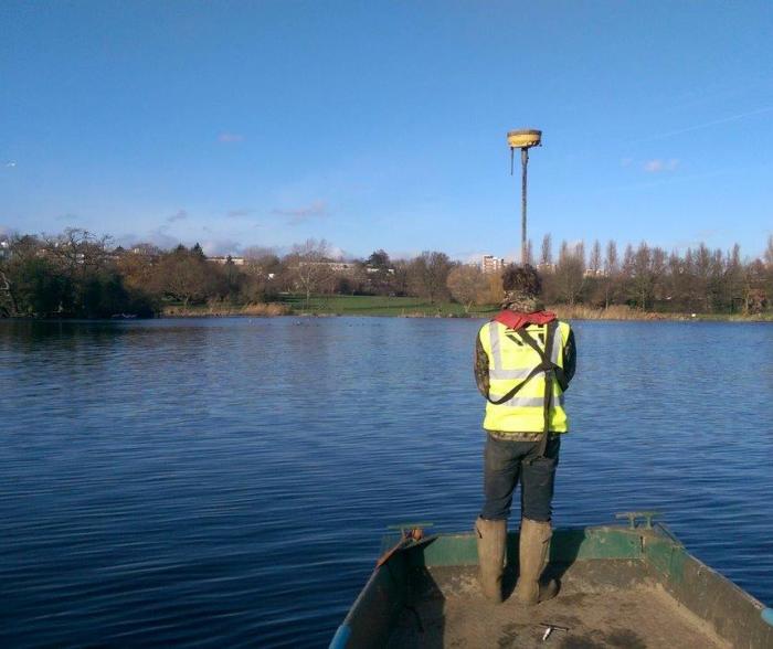
- Bathometric Surveys: (Water Surveys). These are used to identify depth of water and the volumes of silt within water-bodies.
- Earthworks / Volume Surveys: These are used to identify the volumes of material available in spoil heaps
- As-Built Surveys: These are used in describe the results of a completed project.
The surveyed features include:
- Ground levels
- Permanent and temporary buildings/structures.
- Road path, track features.
- Visible boundary features: including walls, fences, hedges, gates.
- Street furniture: bollards, lamp posts, playground equipment.
- Trees: [minimum trunk diameter (at 1m above ground level) to be surveyed 0.1m], wooded areas, limits of vegetation, feature trees.
- Water features: watercourses, water level, lakes (lake edge, lake bed and silt top), streams, reservoirs, bridges, fountains, pipework, culverts, drains, pavements, kerbs.
- Earth works: bank bottom, bank top, hilltops, depressions and saddles (spot heights), mounds, spoil heaps, retaining wall: base and top, sloping masonry, terraces
- Services: As visible at time of survey, defined by cover level, power lines.
Why Choose Us?
- Our 40 years’ experience ensures that all clients are assured of the quality service they will receive.
- We have a team of trained and experienced surveyors, using the latest technology to ensure high precision, reliable and cost-effective surveys every time.
- Professional and Friendly service – where the needs of the client always come first.
- We take the time to understand our clients’ needs to make sure they receive the service they expect; ensuring the client gets the survey they require, on time and within budget.
- Flexibility – we ensure the client’s requirements are met in the time scales required.
- We use the latest equipment and technology to deliver a survey which meets your specific project requirements.
- All surveys provided to Ordnance Survey National Grid (OSGB36) and all levels to AODN (Above Ordnance Datum Newlyn).
- No survey is too big or too small.
- Free Consultancy and Quote (no obligation quotations). We are always looking to start and build new relationships.
- Site photos are included on request.
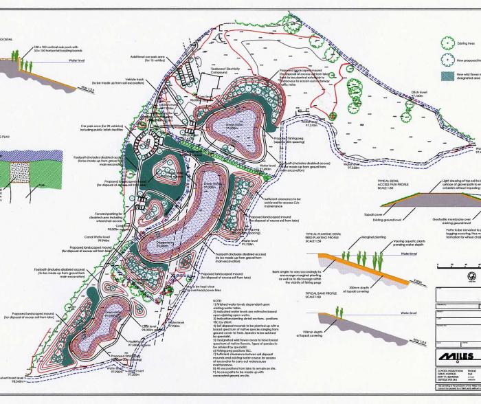
- Drawings are produced in AutoCAD (.dwg), PDF formats created and the finished .xml data file is supplied. This package is sent in electronic format to the client/design consultant.
- All surveys are plotted at a suitable scale to fit A1, A2, A3 or A4 sheet.
Related Projects
